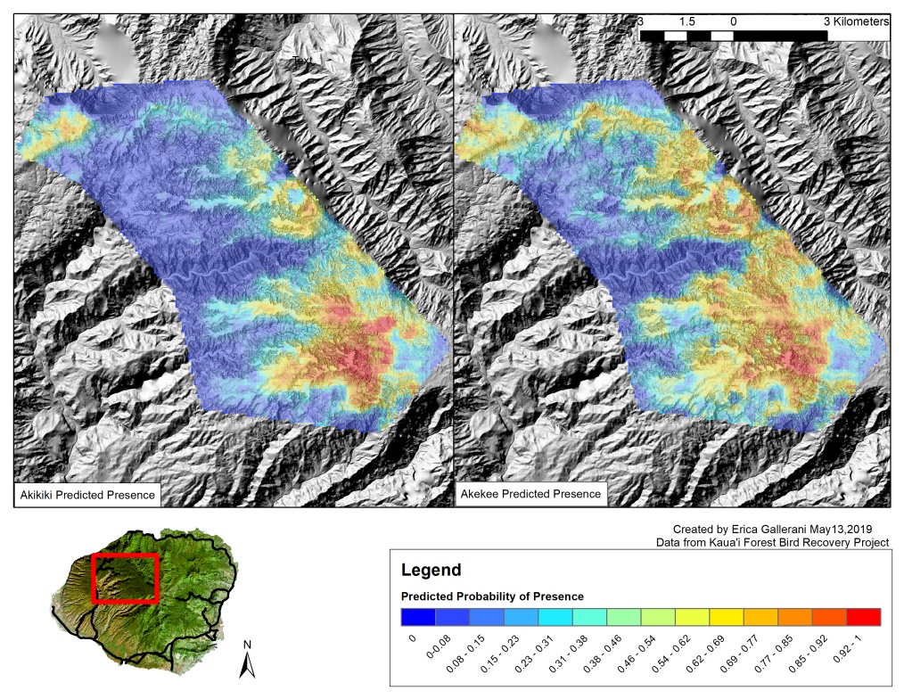
The high-resolution LiDAR (Light Detection and Ranging) data that we acquired in 2017 for the Alakaʻi Swamp has finally come to fruition in the form of predictive modeling. We have analyzed this remotely sensed data to identify forest structure and topography metrics associated with ʻAkikiki and ʻAkekeʻe nest locations (88 for ʻAkikiki and 22 for ʻAkekeʻe) and occurrences (3,706 for ‘Akikiki and 1,581 for ʻAkekeʻe) from 2012-2017 to predict their distribution in unsurveyed areas. As you know, these birds are critically endangered and a better understanding of their range and habitat preferences is essential if we are to continue to steward their recovery. There is also potential for these models to predict the most suitable habitat for future translocations of individual birds. The results show that ʻAkikiki and ʻAkekeʻe forage in areas with significantly different forest structure (maximum tree height, mean canopy height, relative heights) and topography (slope) based on occurrences. Elevation was consistently one of the most important metrics for predicting both species nest locations and occurrences and it appears both species are at the upper limits of their elevational range, making our mosquito work ever more important. We plan to continue to improve these models by adding remotely sensed climate and vegetation data. These models and observations are currently under review for publication…stay tuned!

 Kim Rogers of KISC